 vesseltracker.com
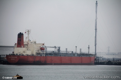
 IONIAN SEA
Current Status
Where is the vessel?
IONIAN SEA is currently in 66 nm S of Accra, based on AIS data received about 1h ago.
Latest AIS update:
Current position: 4.43500° N, 0.03167° W (66 nm S of Accra)
Average speed (last 7 days): Loading…
Average speed (last 30 days): Loading…
Vessel profile: IONIAN SEA is a Chemical Tanker with dimensions m x m.
This page combines live AIS, route history, probable destination signals, nearby traffic, and port activity for practical vessel monitoring.
The current position of vessel IONIAN SEA is 4.43500 lat / -0.03167 lng. Updated: 2026-04-19 16:15:09 UTCNearest reference points:
- Near Sekondi
- Near Takoradi
- Near Ablogamé
Currently sailing under the flag of Liberia ![]()
Details:
Live Vessel IONIAN SEA Analytics (details, animations, etc.)
Recent AIS points (UTC):
2026-04-19 13:58:02 UTC · 4.66293, 0.36710 · SOG 12 kn · COG 243°2026-04-19 14:01:43 UTC · 4.65694, 0.35649 · SOG 11.9 kn · COG 237°
2026-04-19 15:58:22 UTC · 4.46442, 0.01755 · SOG 12.2 kn · COG 236°
2026-04-19 16:15:09 UTC · 4.43500, -0.03167 · SOG 12 kn · COG -1°