 vesseltracker.com
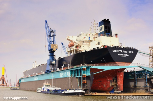
 Chemtrans Sea
Current Status
Where is the vessel?
Chemtrans Sea is currently in 33 nm SW of Cayman Brac, based on AIS data received about 1h ago.
Latest AIS update:
Current position: 19.19947° N, 80.16141° W (33 nm SW of Cayman Brac)
Average speed (last 7 days): Loading…
Average speed (last 30 days): Loading…
Vessel profile: Chemtrans Sea is a Crude Oil Tanker with dimensions 228m x 32m.
This page combines live AIS, route history, probable destination signals, nearby traffic, and port activity for practical vessel monitoring.
The current position of vessel Chemtrans Sea is 19.19947 lat / -80.16141 lng. Updated: 2026-04-20 08:12:03 UTCNearest reference points:
- Near Georgetown, Grand Cayman
Currently sailing under the flag of Liberia ![]()
Chemtrans Sea built in 2004 year
Deadweight:
72365 tDetails:
Live Vessel Chemtrans Sea Analytics (details, animations, etc.)
Recent AIS points (UTC):
2026-04-20 04:09:07 UTC · 19.09231, -80.00527 · SOG 2.7 kn · COG 306°2026-04-20 06:10:53 UTC · 19.14603, -80.08354 · SOG 2.7 kn · COG 306°
2026-04-20 07:52:42 UTC · 19.19093, -80.14897 · SOG 2.7 kn · COG 306°
2026-04-20 08:12:03 UTC · 19.19947, -80.16141 · SOG 2.7 kn · COG 306°