 vesseltracker.com
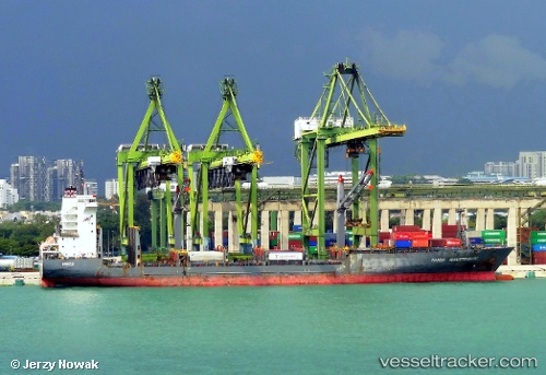
Hansa Breitenburg
Current StatusWhere is the vessel?
Hansa Breitenburg is currently in 41 nm SW of Ledong, based on AIS data received about 1h ago.
Latest AIS update:
Current position: 18.16099° N, 108.24879° E (41 nm SW of Ledong)
Average speed (last 7 days): Loading…
Average speed (last 30 days): Loading…
Vessel profile: Hansa Breitenburg is a Container Ship with dimensions 27m x 174m.
This page combines live AIS, route history, probable destination signals, nearby traffic, and port activity for practical vessel monitoring.
The current position of vessel Hansa Breitenburg is 18.16099 lat / 108.24879 lng. Updated: 2026-04-20 08:01:28 UTCNearest reference points:
- 60 nm SW of Ledong
- 61 nm E of Hon La Port
- 48 nm NE of Cua Viet Port
Details:
Live Vessel Hansa Breitenburg Analytics (details, animations, etc.)
Recent AIS points (UTC):
2026-04-20 04:45:28 UTC · 17.61304, 108.28777 · SOG 10 kn · COG 351°2026-04-20 06:12:38 UTC · 17.85557, 108.25733 · SOG 10 kn · COG 9°
2026-04-20 07:41:04 UTC · 18.10500, 108.25167 · SOG 10 kn · COG -1°
2026-04-20 08:01:28 UTC · 18.16099, 108.24879 · SOG 9.6 kn · COG 4°