 vesseltracker.com
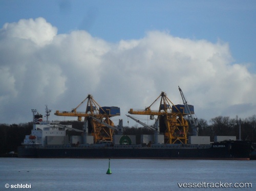
Columbia
Current StatusWhere is the vessel?
Columbia is currently in Near Ama, based on AIS data received about 1h ago.
Latest AIS update:
Current position: 29.96288° N, 90.28530° W (Near Ama)
Average speed (last 7 days): Loading…
Average speed (last 30 days): Loading…
Vessel profile: Columbia is a Bulk Carrier with dimensions 32m x 190m.
This page combines live AIS, route history, probable destination signals, nearby traffic, and port activity for practical vessel monitoring.
The current position of vessel Columbia is 29.96288 lat / -90.28530 lng. Updated: 2026-04-01 09:23:59 UTCNearest reference points:
- Near Boutte
- Near Good Hope
- Near Marrero
Details:
Live Vessel Columbia Analytics (details, animations, etc.)
Recent AIS points (UTC):
2026-04-01 03:29:55 UTC · 29.96294, -90.28540 · SOG 0 kn · COG 241°2026-04-01 05:58:30 UTC · 29.96292, -90.28529 · SOG 0 kn · COG -1°
2026-04-01 08:08:56 UTC · 29.96289, -90.28532 · SOG 0 kn · COG 244°
2026-04-01 09:23:59 UTC · 29.96288, -90.28530 · SOG 0 kn · COG 245°