 vesseltracker.com
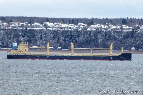
Tanja
Current StatusWhere is the vessel?
Tanja is currently in 57 nm SW of Bahía Honda, based on AIS data received less than 1h ago.
Latest AIS update:
Current position: 6.90500° N, 81.94333° W (57 nm SW of Bahía Honda)
Average speed (last 7 days): Loading…
Average speed (last 30 days): Loading…
Vessel profile: Tanja is a Bulk Carrier with dimensions 23m x 185m.
This page combines live AIS, route history, probable destination signals, nearby traffic, and port activity for practical vessel monitoring.
The current position of vessel Tanja is 6.90500 lat / -81.94333 lng. Updated: 2026-04-20 22:05:49 UTCNearest reference points:
- 20 nm S of El Puerto
- Near Chiriquí Grande
- 30 nm E of El Cirial (Isla Iguana)
Details:
Live Vessel Tanja Analytics (details, animations, etc.)
Recent AIS points (UTC):
2026-04-20 18:14:49 UTC · 7.11667, -82.65833 · SOG 11 kn · COG -1°2026-04-20 18:59:02 UTC · 7.07515, -82.52166 · SOG 11.1 kn · COG 102°
2026-04-20 20:02:47 UTC · 7.02833, -82.33833 · SOG 10 kn · COG -1°
2026-04-20 22:05:49 UTC · 6.90500, -81.94333 · SOG 12 kn · COG -1°