 vesseltracker.com
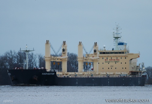
Harvester
Current StatusWhere is the vessel?
Harvester is currently in 379 nm W of Porto Grande, based on AIS data received less than 1h ago.
Latest AIS update:
Current position: 18.08167° N, 31.49500° W (379 nm W of Porto Grande)
Average speed (last 7 days): Loading…
Average speed (last 30 days): Loading…
Vessel profile: Harvester is a Bulk Carrier with dimensions 32m x 180m.
This page combines live AIS, route history, probable destination signals, nearby traffic, and port activity for practical vessel monitoring.
The current position of vessel Harvester is 18.08167 lat / -31.49500 lng. Updated: 2026-04-18 20:04:52 UTCNearest reference points:
- Open sea, approx. 400 nm off the nearest listed port
- Open sea, approx. 401 nm off the nearest listed port
- Open sea, approx. 447 nm off the nearest listed port
Details:
Live Vessel Harvester Analytics (details, animations, etc.)
Recent AIS points (UTC):
2026-04-18 14:16:50 UTC · 17.37667, -32.30333 · SOG 10 kn · COG -1°2026-04-18 15:40:50 UTC · 17.54500, -32.10833 · SOG 10 kn · COG -1°
2026-04-18 18:22:52 UTC · 17.87500, -31.73667 · SOG 11 kn · COG -1°
2026-04-18 20:04:52 UTC · 18.08167, -31.49500 · SOG 10 kn · COG -1°