 vesseltracker.com
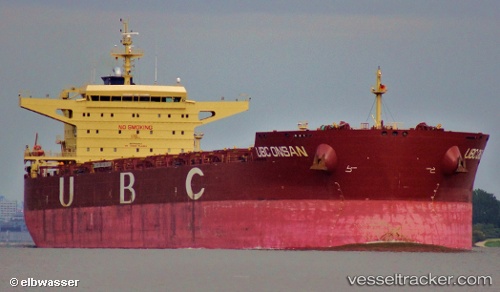
 Robert Oldendorff
Current Status
Where is the vessel?
Robert Oldendorff is currently in 15 nm SE of Redhead, based on AIS data received less than 1h ago.
Latest AIS update:
Current position: 33.16353° S, 151.95766° E (15 nm SE of Redhead)
Average speed (last 7 days): Loading…
Average speed (last 30 days): Loading…
Vessel profile: Robert Oldendorff is a Bulk Carrier with dimensions 260m x 260m.
This page combines live AIS, route history, probable destination signals, nearby traffic, and port activity for practical vessel monitoring.
The current position of vessel Robert Oldendorff is -33.16353 lat / 151.95766 lng. Updated: 2026-03-31 03:58:06 UTCNearest reference points:
- Near Caves Beach
- Near Warners Bay
- Near BILGOLA PLATEAU
Currently sailing under the flag of Liberia ![]()
Robert Oldendorff built in 2011 year
Deadweight:
118590 tDetails:
Live Vessel Robert Oldendorff Analytics (details, animations, etc.)
Recent AIS points (UTC):
2026-03-30 21:39:47 UTC · -33.16786, 151.88428 · SOG 1.3 kn · COG 261°2026-03-30 23:29:06 UTC · -33.15256, 151.96506 · SOG 9.2 kn · COG 70°
2026-03-31 02:13:47 UTC · -33.15046, 151.99255 · SOG 1 kn · COG 185°
2026-03-31 03:58:06 UTC · -33.16353, 151.95766 · SOG 1.1 kn · COG 202°