 vesseltracker.com
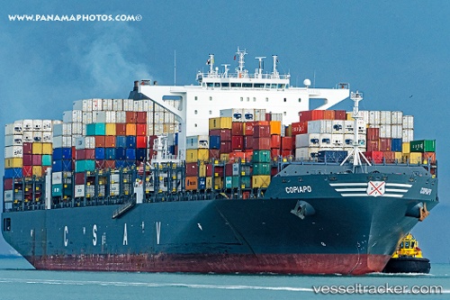
Vessel Copiapo IMO: 9687526, MMSI: 636092775 Container Ship
UTC, 34.39667, -7.89333, course: -1, speed: 15
UTC, 34.70833, -7.41833, course: -1, speed: 14
2026-03-19 09:36:45 UTC, 34.70833, -7.41833, course: -1, speed: 14
Live Vessel Copiapo Analytics (details, animations, etc.)
Live AIS position: UTC. 49 nm NW of Kenitra), updated 2026-03-19 09:36:45 UTC.Find the position of the vessel Copiapo on the map. The latter are known coordinates and path.
marine traffic ship tracker show on live map
The current position of vessel Copiapo is 34.70833 lat / -7.41833 lng. Updated: 2026-03-19 09:36:45 UTCCurrently sailing under the flag of Liberia
Details:
Last coordinates of the vessel:
UTC, 34.39667, -7.89333, course: -1, speed: 15UTC, 34.39667, -7.89333, course: -1, speed: 15
UTC, 34.70833, -7.41833, course: -1, speed: 14
2026-03-19 09:36:45 UTC, 34.70833, -7.41833, course: -1, speed: 14