 vesseltracker.com
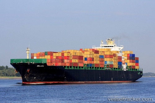
 Bellavia
Current Status
Where is the vessel?
Bellavia is currently in Near Interbay, based on AIS data received about 1h ago.
Latest AIS update:
Current position: 47.58753° N, 122.34577° W (Near Interbay)
Average speed (last 7 days): Loading…
Average speed (last 30 days): Loading…
Vessel profile: Bellavia is a Container Ship with dimensions 294m x 32m.
This page combines live AIS, route history, probable destination signals, nearby traffic, and port activity for practical vessel monitoring.
The current position of vessel Bellavia is 47.58753 lat / -122.34577 lng. Updated: 2026-03-29 23:38:02 UTCNearest reference points:
- Near Interbay
- Near Madison Park
- Near Ballard/Seattle
Currently sailing under the flag of Liberia ![]()
Bellavia built in 2005 year
Deadweight:
66478 tDetails:
Live Vessel Bellavia Analytics (details, animations, etc.)
Recent AIS points (UTC):
2026-03-29 17:45:59 UTC · 47.62905, -122.42938 · SOG 9.2 kn · COG 128°2026-03-29 19:56:01 UTC · 47.58748, -122.34585 · SOG 0 kn · COG 180°
2026-03-29 21:47:00 UTC · 47.58748, -122.34578 · SOG 0 kn · COG 180°
2026-03-29 23:38:02 UTC · 47.58753, -122.34577 · SOG 0 kn · COG 181°