 vesseltracker.com
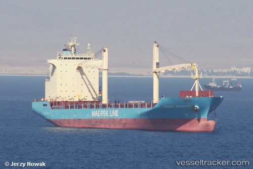
 Maersk Weymouth
Current Status
Where is the vessel?
Maersk Weymouth is currently in 116 nm SW of Raichur, based on AIS data received about 1h ago.
Latest AIS update:
Current position: 15.42500° N, 79.19667° W (116 nm SW of Raichur)
Average speed (last 7 days): Loading…
Average speed (last 30 days): Loading…
Vessel profile: Maersk Weymouth is a Container Ship with dimensions 175m x 28m.
This page combines live AIS, route history, probable destination signals, nearby traffic, and port activity for practical vessel monitoring.
The current position of vessel Maersk Weymouth is 15.42500 lat / -79.19667 lng. Updated: 2026-04-01 21:44:28 UTCCurrently sailing under the flag of Liberia ![]()
Maersk Weymouth built in 2009 year
Deadweight:
22314 tDetails:
Live Vessel Maersk Weymouth Analytics (details, animations, etc.)
Recent AIS points (UTC):
2026-04-01 16:05:25 UTC · 14.04333, -78.24500 · SOG 17 kn · COG -1°2026-04-01 18:17:25 UTC · 14.58667, -78.61833 · SOG 17 kn · COG -1°
2026-04-01 19:53:25 UTC · 14.96833, -78.88500 · SOG 17 kn · COG -1°
2026-04-01 21:44:28 UTC · 15.42500, -79.19667 · SOG 17 kn · COG -1°