 vesseltracker.com
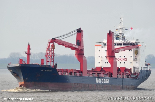
 BILLESBORG
Current Status
Where is the vessel?
BILLESBORG is currently in Open sea, approx. 443 nm off the nearest listed port, based on AIS data received about 39d ago.
Latest AIS update:
Current position: 20.97152° S, 0.02628° W (Open sea, approx. 443 nm off the nearest listed port)
Average speed (last 7 days): Loading…
Average speed (last 30 days): Loading…
Vessel profile: BILLESBORG is a General Cargo Ship with dimensions 139m x 139m.
This page combines live AIS, route history, probable destination signals, nearby traffic, and port activity for practical vessel monitoring.
The current position of vessel BILLESBORG is -20.97152 lat / -0.02628 lng. Updated: 2026-02-22 08:09:42 UTCNearest reference points:
- Open sea, approx. 443 nm off the nearest listed port
- Open sea, approx. 444 nm off the nearest listed port
- Open sea, approx. 448 nm off the nearest listed port
Currently sailing under the flag of Liberia ![]()
BILLESBORG built in 2011 year
Deadweight:
12696 tDetails:
Live Vessel BILLESBORG Analytics (details, animations, etc.)
Recent AIS points (UTC):
2026-02-22 08:09:42 UTC · -20.97152, -0.02628 · SOG -0.1 kn · COG 162°