 vesseltracker.com
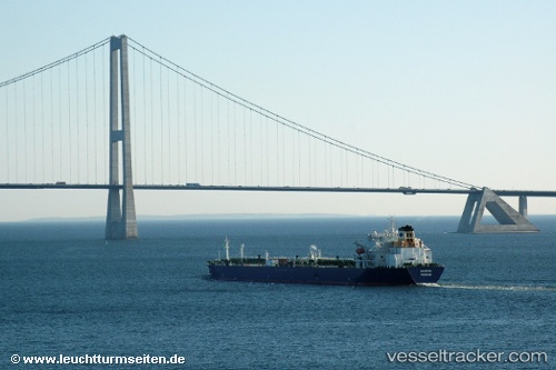
 CHEMTRANS SATURN
Current Status
Where is the vessel?
CHEMTRANS SATURN is currently in 26 nm S of ROQUETAS DE MAR, based on AIS data received about 23d ago.
Latest AIS update:
Current position: 36.32293° N, 2.55479° W (26 nm S of ROQUETAS DE MAR)
Average speed (last 7 days): Loading…
Average speed (last 30 days): Loading…
Vessel profile: CHEMTRANS SATURN is a Crude Oil Tanker with dimensions 228m x 32m.
This page combines live AIS, route history, probable destination signals, nearby traffic, and port activity for practical vessel monitoring.
The current position of vessel CHEMTRANS SATURN is 36.32293 lat / -2.55479 lng. Updated: 2026-03-25 21:43:55 UTCNearest reference points:
- 37 nm S of Las Noras de Daza
- 26 nm S of El Alquian
- 27 nm SE of El Alquian
Currently sailing under the flag of Liberia ![]()
CHEMTRANS SATURN built in 2006 year
Deadweight:
72247 tDetails:
Live Vessel CHEMTRANS SATURN Analytics (details, animations, etc.)
Recent AIS points (UTC):
2026-03-25 21:43:55 UTC · 36.32293, -2.55479 · SOG 4.3 kn · COG 84°