 vesseltracker.com
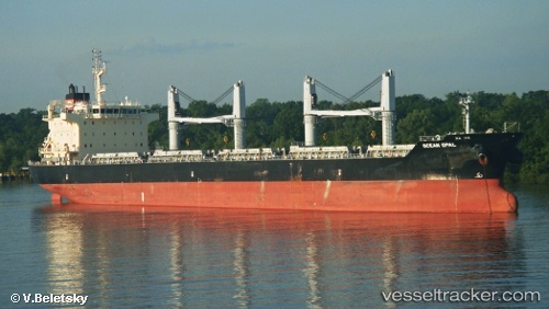
 LIMA STRAIT
Current Status
Where is the vessel?
LIMA STRAIT is currently in Near Anza, based on AIS data received about 1h ago.
Latest AIS update:
Current position: 30.43056° N, 9.69640° W (Near Anza)
Average speed (last 7 days): Loading…
Average speed (last 30 days): Loading…
Vessel profile: LIMA STRAIT is a Bulk Carrier with dimensions 186m x 28m.
This page combines live AIS, route history, probable destination signals, nearby traffic, and port activity for practical vessel monitoring.
The current position of vessel LIMA STRAIT is 30.43056 lat / -9.69640 lng. Updated: 2026-03-31 21:45:13 UTCNearest reference points:
- 64 nm W of Essaouira
- 87 nm W of Essaouira
- 80 nm S of Jarjis
Currently sailing under the flag of Liberia ![]()
LIMA STRAIT built in 2012 year
Deadweight:
37187 tDetails:
Live Vessel LIMA STRAIT Analytics (details, animations, etc.)
Recent AIS points (UTC):
2026-03-31 15:21:08 UTC · 30.43051, -9.69622 · SOG 0 kn · COG 279°2026-03-31 18:09:12 UTC · 30.42963, -9.69687 · SOG 0.2 kn · COG 319°
2026-03-31 19:51:11 UTC · 30.43001, -9.69647 · SOG 0.1 kn · COG 300°
2026-03-31 21:45:13 UTC · 30.43056, -9.69640 · SOG 0 kn · COG 268°