 vesseltracker.com
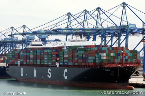
 UNAYZAH EXPRESS
Current Status
Where is the vessel?
UNAYZAH EXPRESS is currently in 45 nm SW of Saldanha Bay, based on AIS data received less than 1h ago.
Latest AIS update:
Current position: 33.43490° S, 17.08122° E (45 nm SW of Saldanha Bay)
Average speed (last 7 days): Loading…
Average speed (last 30 days): Loading…
Vessel profile: UNAYZAH EXPRESS is a Container Ship with dimensions m x m.
This page combines live AIS, route history, probable destination signals, nearby traffic, and port activity for practical vessel monitoring.
The current position of vessel UNAYZAH EXPRESS is -33.43490 lat / 17.08122 lng. Updated: 2026-04-14 15:51:36 UTCNearest reference points:
- 12 nm W of ROBBEN ISLAND
- Near Saint Helena Bay
- 111 nm W of Kommetjie
Currently sailing under the flag of Liberia ![]()
Details:
Live Vessel UNAYZAH EXPRESS Analytics (details, animations, etc.)
Recent AIS points (UTC):
2026-04-14 10:07:30 UTC · -32.10279, 15.68649 · SOG 18.9 kn · COG 139°2026-04-14 11:50:49 UTC · -32.50979, 16.11228 · SOG 18.3 kn · COG 145°
2026-04-14 13:35:54 UTC · -32.93547, 16.49645 · SOG 18.4 kn · COG 145°
2026-04-14 15:51:36 UTC · -33.43490, 17.08122 · SOG 18.7 kn · COG 140°