 vesseltracker.com
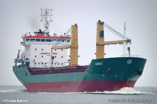
 KARSOY
Current Status
Where is the vessel?
KARSOY is currently in Near Anza, based on AIS data received less than 1h ago.
Latest AIS update:
Current position: 30.42525° N, 9.69618° W (Near Anza)
Average speed (last 7 days): Loading…
Average speed (last 30 days): Loading…
Vessel profile: KARSOY is a General Cargo with dimensions m x m.
This page combines live AIS, route history, probable destination signals, nearby traffic, and port activity for practical vessel monitoring.
The current position of vessel KARSOY is 30.42525 lat / -9.69618 lng. Updated: 2026-04-21 16:28:07 UTCNearest reference points:
- 64 nm W of Essaouira
- 87 nm W of Essaouira
- 80 nm S of Jarjis
Currently sailing under the flag of Liberia ![]()
Details:
Live Vessel KARSOY Analytics (details, animations, etc.)
Recent AIS points (UTC):
2026-04-21 13:49:06 UTC · 30.42575, -9.69621 · SOG 0.1 kn · COG 265°2026-04-21 13:49:06 UTC · 30.42575, -9.69621 · SOG 0.1 kn · COG 265°
2026-04-21 16:25:06 UTC · 30.42516, -9.69617 · SOG 0.1 kn · COG 287°
2026-04-21 16:28:07 UTC · 30.42525, -9.69618 · SOG 0 kn · COG 284°