 vesseltracker.com
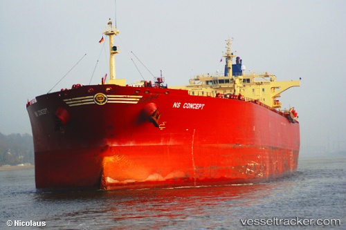
 GUANYIN
Current Status
Where is the vessel?
GUANYIN is currently in Near Ras as Sidr, based on AIS data received about 1h ago.
Latest AIS update:
Current position: 29.43653° N, 32.59907° E (Near Ras as Sidr)
Average speed (last 7 days): Loading…
Average speed (last 30 days): Loading…
Vessel profile: GUANYIN is a Crude Oil Tanker with dimensions m x m.
This page combines live AIS, route history, probable destination signals, nearby traffic, and port activity for practical vessel monitoring.
The current position of vessel GUANYIN is 29.43653 lat / 32.59907 lng. Updated: 2026-04-17 17:39:40 UTCNearest reference points:
- Near Ras Sudr
- Near Al Adabiyah
- Near AL ADABIYAH
Currently sailing under the flag of Madagascar ![]()
Details:
Live Vessel GUANYIN Analytics (details, animations, etc.)
Recent AIS points (UTC):
2026-04-17 12:02:32 UTC · 30.26743, 32.48133 · SOG 9.5 kn · COG 107°2026-04-17 14:04:02 UTC · 29.96953, 32.58681 · SOG 10.6 kn · COG 189°
2026-04-17 16:29:00 UTC · 29.64338, 32.51682 · SOG 11.4 kn · COG 190°
2026-04-17 17:39:40 UTC · 29.43653, 32.59907 · SOG 11.2 kn · COG 155°