 vesseltracker.com
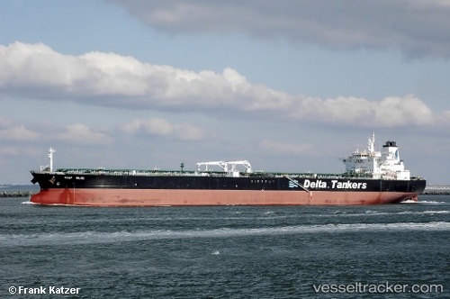
 DEYNA
DEYNA
Current Status
Where is the vessel?
DEYNA is currently in 88 nm NW of Roque De Los Muchachos, based on AIS data received less than 1h ago.
Latest AIS update:
Current position: 30.09289° N, 18.54540° W (88 nm NW of Roque De Los Muchachos)
Average speed (last 7 days): Loading…
Average speed (last 30 days): Loading…
Vessel profile: DEYNA is a Crude Oil Tanker with dimensions m x m.
This page combines live AIS, route history, probable destination signals, nearby traffic, and port activity for practical vessel monitoring.
The current position of vessel DEYNA is 30.09289 lat / -18.54540 lng. Updated: 2026-04-22 02:38:08 UTCNearest reference points:
- Near Tazacorte
- Near Santa Cruz de La Palma
- Near Breña Baja
Currently sailing under the flag of Mozambique ![]()
Details:
Live Vessel DEYNA Analytics (details, animations, etc.)
Recent AIS points (UTC):
2026-04-21 22:00:30 UTC · 30.47330, -17.79543 · SOG 9.9 kn · COG 242°2026-04-21 23:32:50 UTC · 30.34410, -18.04591 · SOG 10.1 kn · COG 242°
2026-04-22 01:41:09 UTC · 30.17058, -18.39222 · SOG 9.9 kn · COG 241°
2026-04-22 02:38:08 UTC · 30.09289, -18.54540 · SOG 9.5 kn · COG 245°