 vesseltracker.com
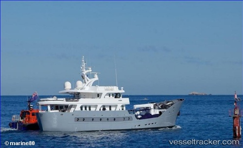
Anda
Current StatusWhere is the vessel?
Anda is currently in Near GRANDE ISLAND, based on AIS data received less than 1h ago.
Latest AIS update:
Current position: 14.81938° N, 120.28649° E (Near GRANDE ISLAND)
Average speed (last 7 days): Loading…
Average speed (last 30 days): Loading…
Vessel profile: Anda is a Yacht with dimensions 7m x 42m.
This page combines live AIS, route history, probable destination signals, nearby traffic, and port activity for practical vessel monitoring.
The current position of vessel Anda is 14.81938 lat / 120.28649 lng. Updated: 2026-03-31 18:03:50 UTCNearest reference points:
- 19 nm SW of MARIVELES
- Near Noveleta
- Near Malabon
Details:
Live Vessel Anda Analytics (details, animations, etc.)
Recent AIS points (UTC):
2026-03-31 11:27:50 UTC · 14.81927, 120.28643 · SOG 0 kn · COG 97°2026-03-31 13:21:49 UTC · 14.81917, 120.28651 · SOG 0 kn · COG 97°
2026-03-31 16:15:50 UTC · 14.81929, 120.28656 · SOG 0 kn · COG 97°
2026-03-31 18:03:50 UTC · 14.81938, 120.28649 · SOG 0 kn · COG 97°