 vesseltracker.com
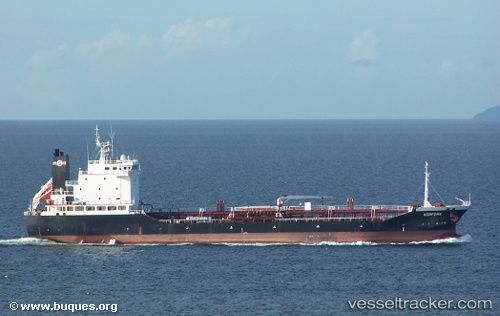
 RAHAMA
Current Status
Where is the vessel?
RAHAMA is currently in 19 nm SW of Port Harcourt, based on AIS data received about 1h ago.
Latest AIS update:
Current position: 4.52685° N, 6.80964° E (19 nm SW of Port Harcourt)
Average speed (last 7 days): Loading…
Average speed (last 30 days): Loading…
Vessel profile: RAHAMA is a Oil Products Tanker with dimensions 21m x 115m.
This page combines live AIS, route history, probable destination signals, nearby traffic, and port activity for practical vessel monitoring.
The current position of vessel RAHAMA is 4.52685 lat / 6.80964 lng. Updated: 2026-04-19 17:39:23 UTCNearest reference points:
- Near Port Harcourt
- 21 nm SW of Bonny
- Near Bonny
Currently sailing under the flag of Nigeria ![]()
RAHAMA built in 2001 year
Deadweight:
8067 tDetails:
Live Vessel RAHAMA Analytics (details, animations, etc.)
Recent AIS points (UTC):
2026-04-19 14:02:09 UTC · 4.56524, 6.99170 · SOG 0.1 kn · COG 179°2026-04-19 16:10:04 UTC · 4.59861, 6.86003 · SOG 8.1 kn · COG 268°
2026-04-19 16:41:55 UTC · 4.56374, 6.99241 · SOG 0.1 kn · COG 314°
2026-04-19 17:39:23 UTC · 4.52685, 6.80964 · SOG 0.2 kn · COG 165°