 vesseltracker.com
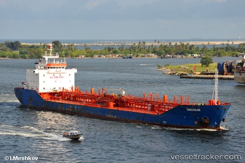
 RATHBONE
Current Status
Where is the vessel?
RATHBONE is currently in Near Bonny, based on AIS data received about 2h ago.
Latest AIS update:
Current position: 4.46702° N, 7.16424° E (Near Bonny)
Average speed (last 7 days): Loading…
Average speed (last 30 days): Loading…
Vessel profile: RATHBONE is a Oil/Chemical Tanker with dimensions m x m.
This page combines live AIS, route history, probable destination signals, nearby traffic, and port activity for practical vessel monitoring.
The current position of vessel RATHBONE is 4.46702 lat / 7.16424 lng. Updated: 2026-04-12 08:04:47 UTCNearest reference points:
- Near Bonny
- Near Onne
- Near Ima
Currently sailing under the flag of Nigeria ![]()
Details:
Live Vessel RATHBONE Analytics (details, animations, etc.)
Recent AIS points (UTC):
2026-04-10 05:54:56 UTC · 4.25159, 6.71908 · SOG 0 kn · COG 110°2026-04-10 06:48:38 UTC · 4.25022, 6.71926 · SOG 0 kn · COG 51°
2026-04-12 07:19:48 UTC · 4.46619, 7.16432 · SOG 0.3 kn · COG 275°
2026-04-12 08:04:47 UTC · 4.46702, 7.16424 · SOG 0 kn · COG 241°