 vesseltracker.com
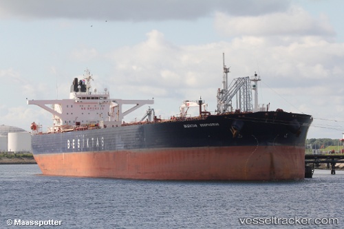
 VELORA
Current Status
Where is the vessel?
VELORA is currently in Near RUMELI FENERI, based on AIS data received less than 1h ago.
Latest AIS update:
Current position: 41.27791° N, 28.95976° E (Near RUMELI FENERI)
Average speed (last 7 days): Loading…
Average speed (last 30 days): Loading…
Vessel profile: VELORA is a Crude Oil Tanker with dimensions m x m.
This page combines live AIS, route history, probable destination signals, nearby traffic, and port activity for practical vessel monitoring.
The current position of vessel VELORA is 41.27791 lat / 28.95976 lng. Updated: 2026-04-10 04:04:31 UTCNearest reference points:
- Near RUMELI FENERI
- Near Istinye/Istambul
- Near Arnavutköy/Istambul
Currently sailing under the flag of Sierra Leone ![]()
Details:
Live Vessel VELORA Analytics (details, animations, etc.)
Recent AIS points (UTC):
2026-04-09 22:00:29 UTC · 41.27785, 28.95955 · SOG 0 kn · COG 313°2026-04-09 23:42:37 UTC · 41.27865, 28.96044 · SOG 0 kn · COG 291°
2026-04-10 02:12:46 UTC · 41.27834, 28.96007 · SOG 0 kn · COG 301°
2026-04-10 04:04:31 UTC · 41.27791, 28.95976 · SOG 0 kn · COG 312°