 vesseltracker.com
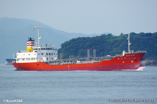
Xiang Shun
Current StatusWhere is the vessel?
Xiang Shun is currently in 24 nm SE of Port de Boké, based on AIS data received less than 1h ago.
Latest AIS update:
Current position: 10.19687° N, 14.48411° W (24 nm SE of Port de Boké)
Average speed (last 7 days): Loading…
Average speed (last 30 days): Loading…
Vessel profile: Xiang Shun is a Oil Products Tanker with dimensions 14m x 86m.
This page combines live AIS, route history, probable destination signals, nearby traffic, and port activity for practical vessel monitoring.
The current position of vessel Xiang Shun is 10.19687 lat / -14.48411 lng. Updated: 2026-03-29 08:21:31 UTCNearest reference points:
- 14 nm S of Port de Boké
- Near Port de Boké
- 49 nm S of Port de Boké
Details:
Live Vessel Xiang Shun Analytics (details, animations, etc.)
Recent AIS points (UTC):
2026-03-29 01:08:44 UTC · 10.13080, -14.70765 · SOG 0.1 kn · COG -1°2026-03-29 03:26:11 UTC · 10.13167, -14.70667 · SOG 0 kn · COG -1°
2026-03-29 05:51:29 UTC · 10.13147, -14.70807 · SOG 0 kn · COG -1°
2026-03-29 08:21:31 UTC · 10.19687, -14.48411 · SOG 6.8 kn · COG 69°