 vesseltracker.com
 MIKATI
Current Status
Where is the vessel?
MIKATI is currently in 13 nm W of Abu Zenimah, based on AIS data received about 3h ago.
Latest AIS update:
Current position: 29.01741° N, 32.84823° E (13 nm W of Abu Zenimah)
Average speed (last 7 days): Loading…
Average speed (last 30 days): Loading…
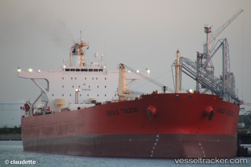
Vessel profile: MIKATI is a Crude Oil Tanker with dimensions 247m x 42m.
This page combines live AIS, route history, probable destination signals, nearby traffic, and port activity for practical vessel monitoring.
The current position of vessel MIKATI is 29.01741 lat / 32.84823 lng. Updated: 2026-04-10 07:10:36 UTCNearest reference points:
- Near Ras Sudr
- Near Al Adabiyah
- Near Ras Gharib
Currently sailing under the flag of Sierra Leone ![]()
MIKATI built in 2003 year
Deadweight:
107092 tDetails:
Live Vessel MIKATI Analytics (details, animations, etc.)
Recent AIS points (UTC):
2026-04-10 02:08:48 UTC · 28.04639, 33.49375 · SOG 13.9 kn · COG 312°2026-04-10 03:41:47 UTC · 28.32037, 33.24355 · SOG 13.3 kn · COG -1°
2026-04-10 05:27:39 UTC · 28.66533, 33.02212 · SOG 13.3 kn · COG 337°
2026-04-10 07:10:36 UTC · 29.01741, 32.84823 · SOG 13.8 kn · COG 338°