 vesseltracker.com
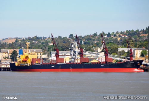
 AK HALIMA
Current Status
Where is the vessel?
AK HALIMA is currently in Near Nouakchott, based on AIS data received about 1h ago.
Latest AIS update:
Current position: 17.98600° N, 16.02878° W (Near Nouakchott)
Average speed (last 7 days): Loading…
Average speed (last 30 days): Loading…
Vessel profile: AK HALIMA is a Bulk Carrier with dimensions m x m.
This page combines live AIS, route history, probable destination signals, nearby traffic, and port activity for practical vessel monitoring.
The current position of vessel AK HALIMA is 17.98600 lat / -16.02878 lng. Updated: 2026-04-19 02:02:45 UTCNearest reference points:
- 90 nm W of Nouakchott
- 96 nm NW of Nouakchott
- 100 nm NW of Saint Louis
Currently sailing under the flag of Sierra Leone ![]()
Details:
Live Vessel AK HALIMA Analytics (details, animations, etc.)
Recent AIS points (UTC):
2026-04-18 20:20:46 UTC · 17.98601, -16.02878 · SOG 0 kn · COG 91°2026-04-18 21:23:46 UTC · 17.98600, -16.02878 · SOG 0.1 kn · COG 91°
2026-04-19 00:14:45 UTC · 17.98599, -16.02879 · SOG 0 kn · COG 91°
2026-04-19 02:02:45 UTC · 17.98600, -16.02878 · SOG 0 kn · COG 91°