 vesseltracker.com
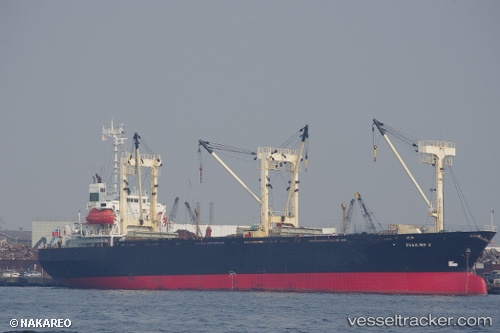
Khaled A
Current StatusWhere is the vessel?
Khaled A is currently in 44 nm W of Yanbu al-Bahr, based on AIS data received less than 1h ago.
Latest AIS update:
Current position: 24.05343° N, 37.22633° E (44 nm W of Yanbu al-Bahr)
Average speed (last 7 days): Loading…
Average speed (last 30 days): Loading…
Vessel profile: Khaled A is a General Cargo Ship with dimensions 22m x 98m.
This page combines live AIS, route history, probable destination signals, nearby traffic, and port activity for practical vessel monitoring.
The current position of vessel Khaled A is 24.05343 lat / 37.22633 lng. Updated: 2026-04-21 17:49:57 UTCNearest reference points:
- 30 nm SW of Yanbu
- 35 nm S of Umm Lajj
- 74 nm SW of Yanbu
Details:
Live Vessel Khaled A Analytics (details, animations, etc.)
Recent AIS points (UTC):
2026-04-21 14:11:25 UTC · 23.99008, 37.41070 · SOG 3.4 kn · COG 275°2026-04-21 15:25:06 UTC · 23.99761, 37.36062 · SOG 1.9 kn · COG 317°
2026-04-21 16:57:47 UTC · 24.02272, 37.28408 · SOG 4 kn · COG 314°
2026-04-21 17:49:57 UTC · 24.05343, 37.22633 · SOG 4.5 kn · COG 313°