 vesseltracker.com
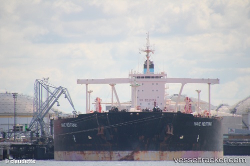
 NEUTRINO
Current Status
Where is the vessel?
NEUTRINO is currently in Near DONGJIAKOU, based on AIS data received about 3d ago.
Latest AIS update:
Current position: 35.56916° N, 119.77731° E (Near DONGJIAKOU)
Average speed (last 7 days): Loading…
Average speed (last 30 days): Loading…
Vessel profile: NEUTRINO is a Crude Oil Tanker with dimensions 333m x 60m.
This page combines live AIS, route history, probable destination signals, nearby traffic, and port activity for practical vessel monitoring.
The current position of vessel NEUTRINO is 35.56916 lat / 119.77731 lng. Updated: 2026-03-23 17:04:12 UTCNearest reference points:
- Near DONGJIAKOU
- Near Rizhao Pt
- 14 nm S of DONGJIAKOU
Currently sailing under the flag of Togo ![]()
NEUTRINO built in 2003 year
Deadweight:
298330 tDetails:
Live Vessel NEUTRINO Analytics (details, animations, etc.)
Recent AIS points (UTC):
2026-03-23 17:04:12 UTC · 35.56916, 119.77731 · SOG 0 kn · COG -1°2026-03-23 17:04:12 UTC · 35.56916, 119.77731 · SOG 0 kn · COG -1°
2026-03-23 17:04:12 UTC · 35.56916, 119.77731 · SOG 0 kn · COG -1°