 vesseltracker.com
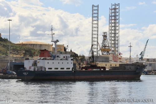
 EDRO IV
Current Status
Where is the vessel?
EDRO IV is currently in Near Shinari Zakynthou, based on AIS data received less than 1h ago.
Latest AIS update:
Current position: 37.97109° N, 20.60544° E (Near Shinari Zakynthou)
Average speed (last 7 days): Loading…
Average speed (last 30 days): Loading…
Vessel profile: EDRO IV is a General Cargo with dimensions m x m.
This page combines live AIS, route history, probable destination signals, nearby traffic, and port activity for practical vessel monitoring.
The current position of vessel EDRO IV is 37.97109 lat / 20.60544 lng. Updated: 2026-04-22 05:58:37 UTCNearest reference points:
- Near Meganísi
- Near Nidhríon
- Near MESSOLOGGI
Currently sailing under the flag of Togo ![]()
Details:
Live Vessel EDRO IV Analytics (details, animations, etc.)
Recent AIS points (UTC):
2026-04-22 02:18:07 UTC · 37.79021, 19.95995 · SOG 8.7 kn · COG 75°2026-04-22 04:12:16 UTC · 37.88211, 20.29480 · SOG 8.8 kn · COG 75°
2026-04-22 04:40:16 UTC · 37.90332, 20.37727 · SOG 8.8 kn · COG 75°
2026-04-22 05:58:37 UTC · 37.97109, 20.60544 · SOG 8.7 kn · COG 75°