 vesseltracker.com
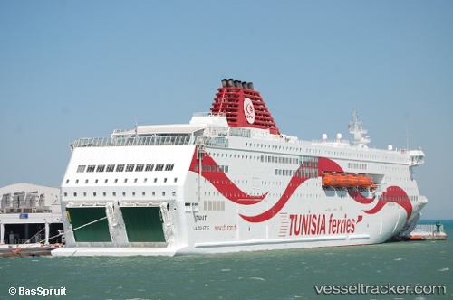
Tanit
Current StatusWhere is the vessel?
Tanit is currently in Near Le Kram, based on AIS data received about 22h ago.
Latest AIS update:
Current position: 36.80754° N, 10.30430° E (Near Le Kram)
Average speed (last 7 days): Loading…
Average speed (last 30 days): Loading…
Vessel profile: Tanit is a Passenger Ro Ro Cargo Ship with dimensions 30m x 210m.
This page combines live AIS, route history, probable destination signals, nearby traffic, and port activity for practical vessel monitoring.
The current position of vessel Tanit is 36.80754 lat / 10.30430 lng. Updated: 2026-04-10 07:19:34 UTCNearest reference points:
- Near Le Kram
- 13 nm N of Qulaybiyah
- 32 nm N of Qulaybiyah
Details:
Live Vessel Tanit Analytics (details, animations, etc.)
Recent AIS points (UTC):
2026-04-10 02:21:32 UTC · 36.80754, 10.30430 · SOG 0 kn · COG 129°2026-04-10 03:46:38 UTC · 36.80833, 10.30500 · SOG 0 kn · COG -1°
2026-04-10 05:57:33 UTC · 36.80751, 10.30430 · SOG 0 kn · COG 129°
2026-04-10 07:19:34 UTC · 36.80754, 10.30430 · SOG 0 kn · COG 129°