 vesseltracker.com
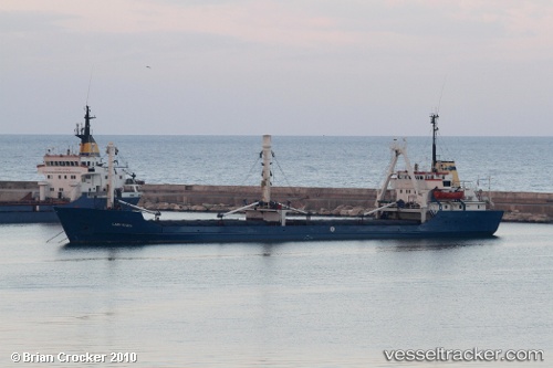
 Lady Rasha
Current Status
Where is the vessel?
Lady Rasha is currently in 28 nm NE of Samsun, based on AIS data received less than 1h ago.
Latest AIS update:
Current position: 41.62945° N, 36.83285° E (28 nm NE of Samsun)
Average speed (last 7 days): Loading…
Average speed (last 30 days): Loading…
Vessel profile: Lady Rasha is a Livestock Carrier with dimensions 80m x 14m.
This page combines live AIS, route history, probable destination signals, nearby traffic, and port activity for practical vessel monitoring.
The current position of vessel Lady Rasha is 41.62945 lat / 36.83285 lng. Updated: 2026-04-17 12:05:48 UTCNearest reference points:
- Near Samsun
- 15 nm W of UNYE
- Near Fatsa
Currently sailing under the flag of Tanzania ![]()
Lady Rasha built in 1972 year
Deadweight:
2995 tDetails:
Live Vessel Lady Rasha Analytics (details, animations, etc.)
Recent AIS points (UTC):
2026-04-17 05:59:15 UTC · 41.99606, 35.87553 · SOG 5.9 kn · COG 113°2026-04-17 07:43:59 UTC · 41.93151, 36.09508 · SOG 7 kn · COG 100°
2026-04-17 10:23:49 UTC · 41.76785, 36.54032 · SOG 9 kn · COG 123°
2026-04-17 12:05:48 UTC · 41.62945, 36.83285 · SOG 9.1 kn · COG 126°