 vesseltracker.com
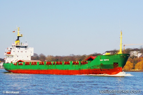
 SKY LIGHT
Current Status
Where is the vessel?
SKY LIGHT is currently in 23 nm W of Ras Silata, based on AIS data received less than 1h ago.
Latest AIS update:
Current position: 34.41712° N, 35.21183° E (23 nm W of Ras Silata)
Average speed (last 7 days): Loading…
Average speed (last 30 days): Loading…
Vessel profile: SKY LIGHT is a General Cargo with dimensions m x m.
This page combines live AIS, route history, probable destination signals, nearby traffic, and port activity for practical vessel monitoring.
The current position of vessel SKY LIGHT is 34.41712 lat / 35.21183 lng. Updated: 2026-04-13 02:40:18 UTCNearest reference points:
- Near Tripoli
- Near Zouk
- Near DBAIYEH
Currently sailing under the flag of Tanzania ![]()
Details:
Live Vessel SKY LIGHT Analytics (details, animations, etc.)
Recent AIS points (UTC):
2026-04-12 18:30:36 UTC · 35.39590, 35.39430 · SOG 7.8 kn · COG 176°2026-04-12 21:22:45 UTC · 35.03038, 35.39695 · SOG 7.8 kn · COG 179°
2026-04-13 00:01:06 UTC · 34.72087, 35.31192 · SOG 6.9 kn · COG 191°
2026-04-13 02:40:18 UTC · 34.41712, 35.21183 · SOG 6.9 kn · COG 184°