 vesseltracker.com
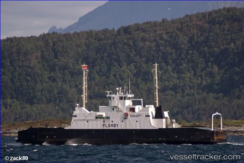
 Levanger
Current Status
Where is the vessel?
Levanger is currently in Near Levanger, based on AIS data received about 1d ago.
Latest AIS update:
Current position: 63.75140° N, 11.29727° E (Near Levanger)
Average speed (last 7 days): Loading…
Average speed (last 30 days): Loading…
Vessel profile: Levanger is a Passenger Ro Ro Cargo Ship with dimensions 50m x 12m.
This page combines live AIS, route history, probable destination signals, nearby traffic, and port activity for practical vessel monitoring.
The current position of vessel Levanger is 63.75140 lat / 11.29727 lng. Updated: 2026-04-10 07:25:39 UTCNearest reference points:
- Near Leksvik
- Near Hommelvik
- Near Utvorda
Currently sailing under the flag of Norway ![]()
Levanger built in 1968 year
Deadweight:
165 tDetails:
Live Vessel Levanger Analytics (details, animations, etc.)
Recent AIS points (UTC):
2026-04-10 02:22:40 UTC · 63.75137, 11.29727 · SOG 0 kn · COG 120°2026-04-10 03:49:37 UTC · 63.75138, 11.29725 · SOG 0 kn · COG 121°
2026-04-10 05:58:39 UTC · 63.75140, 11.29725 · SOG 0 kn · COG 119°
2026-04-10 07:25:39 UTC · 63.75140, 11.29727 · SOG 0 kn · COG 120°