 vesseltracker.com
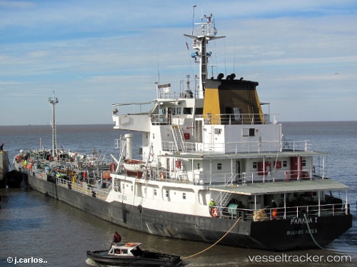
Paranai
Current StatusWhere is the vessel?
Paranai is currently in Near Las Palmas, based on AIS data received less than 1h ago.
Latest AIS update:
Current position: 33.91600° S, 59.07486° W (Near Las Palmas)
Average speed (last 7 days): Loading…
Average speed (last 30 days): Loading…
Vessel profile: Paranai is a Oil Products Tanker with dimensions 19m x 104m.
This page combines live AIS, route history, probable destination signals, nearby traffic, and port activity for practical vessel monitoring.
The current position of vessel Paranai is -33.91600 lat / -59.07486 lng. Updated: 2026-04-18 13:58:51 UTCNearest reference points:
- 10 nm NW of San Pedro
- Near Avellaneda
- Near Dock Sur
Details:
Live Vessel Paranai Analytics (details, animations, etc.)
Recent AIS points (UTC):
2026-04-18 07:28:04 UTC · -34.00470, -58.42254 · SOG 5.8 kn · COG 282°2026-04-18 10:02:10 UTC · -33.99777, -58.69866 · SOG 6.3 kn · COG 322°
2026-04-18 11:42:42 UTC · -33.93386, -58.86994 · SOG 5.9 kn · COG 324°
2026-04-18 13:58:51 UTC · -33.91600, -59.07486 · SOG 5.9 kn · COG 286°