 vesseltracker.com
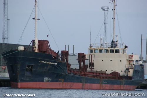
 Lady Of Chichester
Current Status
Where is the vessel?
Lady Of Chichester is currently in 25 nm W of Thyborøn, based on AIS data received about 1h ago.
Latest AIS update:
Current position: 56.77257° N, 7.45867° E (25 nm W of Thyborøn)
Average speed (last 7 days): Loading…
Average speed (last 30 days): Loading…
Vessel profile: Lady Of Chichester is a Dredger with dimensions 60m x 12m.
This page combines live AIS, route history, probable destination signals, nearby traffic, and port activity for practical vessel monitoring.
The current position of vessel Lady Of Chichester is 56.77257 lat / 7.45867 lng. Updated: 2026-04-18 19:22:12 UTCNearest reference points:
- 36 nm W of HVIDE SANDE
- Near Thyborøn
- Near HANSTHOLM
Currently sailing under the flag of Malta ![]()
Lady Of Chichester built in 1970 year
Deadweight:
1726 tDetails:
Live Vessel Lady Of Chichester Analytics (details, animations, etc.)
Recent AIS points (UTC):
2026-04-18 14:04:43 UTC · 56.68084, 8.23028 · SOG 0 kn · COG -1°2026-04-18 16:24:53 UTC · 56.72089, 8.14011 · SOG 9.3 kn · COG -1°
2026-04-18 17:33:43 UTC · 56.74725, 7.82163 · SOG 9.2 kn · COG -1°
2026-04-18 19:22:12 UTC · 56.77257, 7.45867 · SOG 0.4 kn · COG -1°