 vesseltracker.com
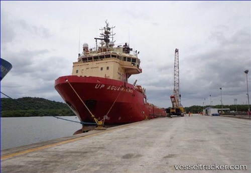
Up Agua Marinha
Current StatusWhere is the vessel?
Up Agua Marinha is currently in Near NITEROI, based on AIS data received about 2h ago.
Latest AIS update:
Current position: 22.85455° S, 43.13110° W (Near NITEROI)
Average speed (last 7 days): Loading…
Average speed (last 30 days): Loading…
Vessel profile: Up Agua Marinha is a Offshore Tug Supply Ship with dimensions 17m x 85m.
This page combines live AIS, route history, probable destination signals, nearby traffic, and port activity for practical vessel monitoring.
The current position of vessel Up Agua Marinha is -22.85455 lat / -43.13110 lng. Updated: 2026-04-06 01:28:54 UTCNearest reference points:
- Near NITEROI
- Near Rio De Janeiro
- Near Santos Dumont Apt/Rio de Janeiro
Details:
Live Vessel Up Agua Marinha Analytics (details, animations, etc.)
Recent AIS points (UTC):
2026-04-05 20:22:53 UTC · -22.85475, -43.13146 · SOG 0 kn · COG 48°2026-04-05 22:04:56 UTC · -22.85490, -43.13142 · SOG 0 kn · COG 14°
2026-04-05 23:55:55 UTC · -22.85476, -43.13124 · SOG 0 kn · COG 9°
2026-04-06 01:28:54 UTC · -22.85455, -43.13110 · SOG 0 kn · COG 197°