 vesseltracker.com
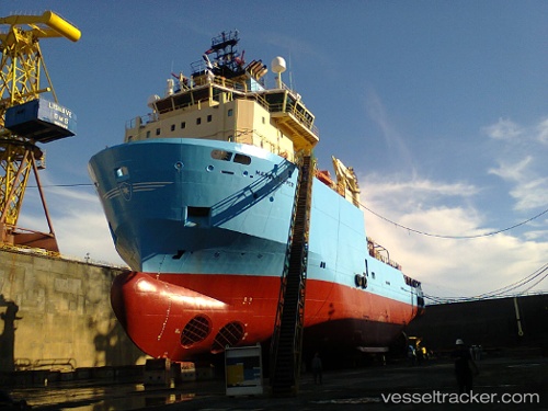
Maersk Topper
Current StatusWhere is the vessel?
Maersk Topper is currently in 47 nm SE of Arraial do Cabo, based on AIS data received about 1h ago.
Latest AIS update:
Current position: 23.32833° S, 41.25833° W (47 nm SE of Arraial do Cabo)
Average speed (last 7 days): Loading…
Average speed (last 30 days): Loading…
Vessel profile: Maersk Topper is a Offshore Tug Supply Ship with dimensions 20m x 80m.
This page combines live AIS, route history, probable destination signals, nearby traffic, and port activity for practical vessel monitoring.
The current position of vessel Maersk Topper is -23.32833 lat / -41.25833 lng. Updated: 2026-04-09 12:21:40 UTCNearest reference points:
- 47 nm E of Arraial do Cabo
- 24 nm SE of Carapebus
- Near Fluminense FPSO
Details:
Live Vessel Maersk Topper Analytics (details, animations, etc.)
Recent AIS points (UTC):
2026-04-09 05:43:15 UTC · -23.32899, -41.26058 · SOG 0.1 kn · COG 187°2026-04-09 07:46:19 UTC · -23.32886, -41.26040 · SOG 0.2 kn · COG 175°
2026-04-09 09:24:55 UTC · -23.32858, -41.26165 · SOG 0.2 kn · COG 179°
2026-04-09 12:21:40 UTC · -23.32833, -41.25833 · SOG 0 kn · COG -1°