 vesseltracker.com
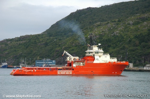
 ATLANTIC KINGFISHER
Current Status
Where is the vessel?
ATLANTIC KINGFISHER is currently in 31 nm E of Açu Pt/São João da Barra, based on AIS data received less than 1h ago.
Latest AIS update:
Current position: 21.67955° S, 40.46400° W (31 nm E of Açu Pt/São João da Barra)
Average speed (last 7 days): Loading…
Average speed (last 30 days): Loading…
Vessel profile: ATLANTIC KINGFISHER is a Anchor Handling Vessel with dimensions m x m.
This page combines live AIS, route history, probable destination signals, nearby traffic, and port activity for practical vessel monitoring.
The current position of vessel ATLANTIC KINGFISHER is -21.67955 lat / -40.46400 lng. Updated: 2026-03-29 09:37:48 UTCNearest reference points:
- Near PORTO DO ACU
- Near Capixaba FPSO
- Near Fluminense FPSO
Details:
Live Vessel ATLANTIC KINGFISHER Analytics (details, animations, etc.)
Recent AIS points (UTC):
2026-03-29 04:07:21 UTC · -21.20356, -39.97158 · SOG 1.9 kn · COG 346°2026-03-29 05:39:12 UTC · -21.18259, -40.03913 · SOG 9.5 kn · COG 220°
2026-03-29 08:21:03 UTC · -21.52024, -40.32546 · SOG 10.1 kn · COG 220°
2026-03-29 09:37:48 UTC · -21.67955, -40.46400 · SOG 9.3 kn · COG 227°