 vesseltracker.com
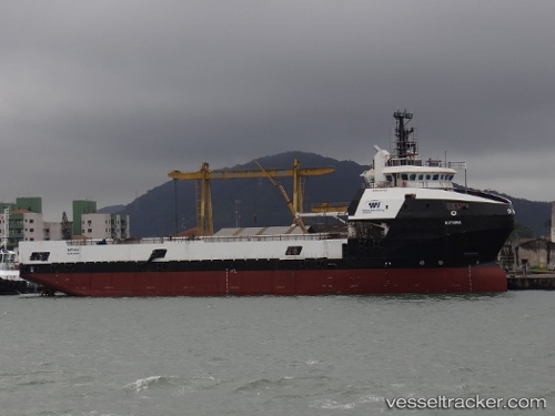
Batuira
Current StatusWhere is the vessel?
Batuira is currently in Near Capixaba FPSO, based on AIS data received about 2h ago.
Latest AIS update:
Current position: 21.24833° S, 40.04167° W (Near Capixaba FPSO)
Average speed (last 7 days): Loading…
Average speed (last 30 days): Loading…
Vessel profile: Batuira is a Offshore Tug Supply Ship with dimensions 16m x 88m.
This page combines live AIS, route history, probable destination signals, nearby traffic, and port activity for practical vessel monitoring.
The current position of vessel Batuira is -21.24833 lat / -40.04167 lng. Updated: 2026-04-20 10:09:43 UTCNearest reference points:
- Near Capixaba FPSO
- Near Tubarão Pt./Vitória
- Near JARDIM CAMBURI
Details:
Live Vessel Batuira Analytics (details, animations, etc.)
Recent AIS points (UTC):
2026-04-20 07:03:45 UTC · -21.25167, -40.03833 · SOG 0 kn · COG -1°2026-04-20 07:28:04 UTC · -21.25098, -40.04097 · SOG 0.4 kn · COG 213°
2026-04-20 09:51:44 UTC · -21.24833, -40.04333 · SOG 0 kn · COG -1°
2026-04-20 10:09:43 UTC · -21.24833, -40.04167 · SOG 0 kn · COG -1°