 vesseltracker.com
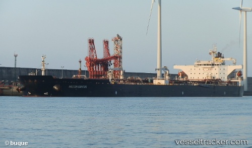
 MILTON SANTOS
Current Status
Where is the vessel?
MILTON SANTOS is currently in 77 nm NE of Cidade de Angra dos Reis FPSO, based on AIS data received about 1h ago.
Latest AIS update:
Current position: 24.49748° S, 42.01059° W (77 nm NE of Cidade de Angra dos Reis FPSO)
Average speed (last 7 days): Loading…
Average speed (last 30 days): Loading…
Vessel profile: MILTON SANTOS is a Tanker with dimensions m x m.
This page combines live AIS, route history, probable destination signals, nearby traffic, and port activity for practical vessel monitoring.
The current position of vessel MILTON SANTOS is -24.49748 lat / -42.01059 lng. Updated: 2026-04-20 19:58:47 UTCNearest reference points:
- 69 nm NE of Cidade de Angra dos Reis FPSO
- 47 nm E of Arraial do Cabo
- 34 nm S of Cidade de Angra dos Reis FPSO
Details:
Live Vessel MILTON SANTOS Analytics (details, animations, etc.)
Recent AIS points (UTC):
2026-04-20 16:12:38 UTC · -24.42976, -41.89955 · SOG 12.6 kn · COG 226°2026-04-20 17:52:34 UTC · -24.53328, -42.03177 · SOG 0.4 kn · COG 124°
2026-04-20 19:47:58 UTC · -24.50038, -42.01174 · SOG 0.7 kn · COG 125°
2026-04-20 19:58:47 UTC · -24.49748, -42.01059 · SOG 0.3 kn · COG 124°