 vesseltracker.com
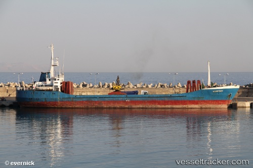
 Artemis S
Current Status
Where is the vessel?
Artemis S is currently in 20 nm SW of PATMOS, based on AIS data received about 3h ago.
Latest AIS update:
Current position: 37.02797° N, 26.36301° E (20 nm SW of PATMOS)
Average speed (last 7 days): Loading…
Average speed (last 30 days): Loading…
Vessel profile: Artemis S is a General Cargo Ship with dimensions 74m x 11m.
This page combines live AIS, route history, probable destination signals, nearby traffic, and port activity for practical vessel monitoring.
The current position of vessel Artemis S is 37.02797 lat / 26.36301 lng. Updated: 2026-03-28 18:45:19 UTCNearest reference points:
- 18 nm SW of PATMOS
- Near Aigiali Amorgou
- Near PATMOS
Currently sailing under the flag of Greece ![]()
Artemis S built in 1971 year
Deadweight:
2039 tDetails:
Live Vessel Artemis S Analytics (details, animations, etc.)
Recent AIS points (UTC):
2026-03-28 10:32:05 UTC · 37.12667, 26.88167 · SOG 0 kn · COG -1°2026-03-28 15:40:40 UTC · 37.08325, 26.80361 · SOG 7.3 kn · COG 260°
2026-03-28 18:08:49 UTC · 37.03584, 26.45528 · SOG 7.1 kn · COG 261°
2026-03-28 18:45:19 UTC · 37.02797, 26.36301 · SOG 7.2 kn · COG 264°