 vesseltracker.com
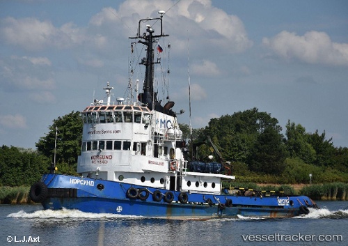
 Norsund
Current Status
Where is the vessel?
Norsund is currently in Near Petropavlovsk-Kamchatskiy, based on AIS data received about 9h ago.
Latest AIS update:
Current position: 52.90159° N, 158.43777° E (Near Petropavlovsk-Kamchatskiy)
Average speed (last 7 days): Loading…
Average speed (last 30 days): Loading…
Vessel profile: Norsund is a Tug with dimensions 31m x 31m.
This page combines live AIS, route history, probable destination signals, nearby traffic, and port activity for practical vessel monitoring.
The current position of vessel Norsund is 52.90159 lat / 158.43777 lng. Updated: 2026-03-30 22:37:56 UTCNearest reference points:
- Near Petropavlovsk-Kamchatskiy
- 11 nm NW of Petropavlovsk-Kamchatskiy
- 16 nm SE of Petropavlovsk-Kamchatskiy
Currently sailing under the flag of Russia ![]()
Norsund built in 1971 year
Deadweight:
160 tDetails:
Live Vessel Norsund Analytics (details, animations, etc.)
Recent AIS points (UTC):
2026-03-29 08:49:45 UTC · 52.90173, 158.43796 · SOG 0.4 kn · COG 264°2026-03-30 22:37:56 UTC · 52.90159, 158.43777 · SOG 0.7 kn · COG 267°
2026-03-30 22:37:56 UTC · 52.90159, 158.43777 · SOG 0.7 kn · COG 267°
2026-03-30 22:37:56 UTC · 52.90159, 158.43777 · SOG 0.7 kn · COG 267°