 vesseltracker.com
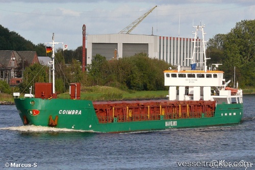
 Coimbra
Current Status
Where is the vessel?
Coimbra is currently in 225 nm SE of Punta Medanos, based on AIS data received less than 1h ago.
Latest AIS update:
Current position: 38.76184° S, 52.59495° W (225 nm SE of Punta Medanos)
Average speed (last 7 days): Loading…
Average speed (last 30 days): Loading…
Vessel profile: Coimbra is a Fishing Vessel with dimensions 80m x 12m.
This page combines live AIS, route history, probable destination signals, nearby traffic, and port activity for practical vessel monitoring.
The current position of vessel Coimbra is -38.76184 lat / -52.59495 lng. Updated: 2026-04-21 10:17:55 UTCNearest reference points:
- 91 nm SE of Punta Medanos
Currently sailing under the flag of Portugal ![]()
Coimbra built in 1973 year
Deadweight:
1702 tDetails:
Live Vessel Coimbra Analytics (details, animations, etc.)
Recent AIS points (UTC):
2026-04-21 07:45:45 UTC · -39.09707, -52.92045 · SOG 10.8 kn · COG -1°2026-04-21 07:45:45 UTC · -39.09707, -52.92045 · SOG 10.8 kn · COG -1°
2026-04-21 09:46:50 UTC · -38.83098, -52.66097 · SOG 9.3 kn · COG -1°
2026-04-21 10:17:55 UTC · -38.76184, -52.59495 · SOG 9.6 kn · COG -1°