 vesseltracker.com
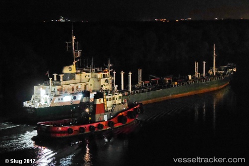
Libertad 1
Current StatusWhere is the vessel?
Libertad 1 is currently in Near La Libertad, based on AIS data received about 1h ago.
Latest AIS update:
Current position: 2.19385° S, 80.89893° W (Near La Libertad)
Average speed (last 7 days): Loading…
Average speed (last 30 days): Loading…
Vessel profile: Libertad 1 is a Chemical Oil Products Tanker with dimensions 11m x 103m.
This page combines live AIS, route history, probable destination signals, nearby traffic, and port activity for practical vessel monitoring.
The current position of vessel Libertad 1 is -2.19385 lat / -80.89893 lng. Updated: 2026-04-20 23:53:32 UTCNearest reference points:
- Near La Libertad
- Near Guayaquil
- Near Samborondon
Details:
Live Vessel Libertad 1 Analytics (details, animations, etc.)
Recent AIS points (UTC):
2026-04-20 20:17:33 UTC · -2.19273, -80.89876 · SOG 0.1 kn · COG 235°2026-04-20 22:05:33 UTC · -2.19340, -80.89863 · SOG 0 kn · COG 287°
2026-04-20 22:32:34 UTC · -2.19351, -80.89863 · SOG 0.1 kn · COG 293°
2026-04-20 23:53:32 UTC · -2.19385, -80.89893 · SOG 0.1 kn · COG 328°