 vesseltracker.com
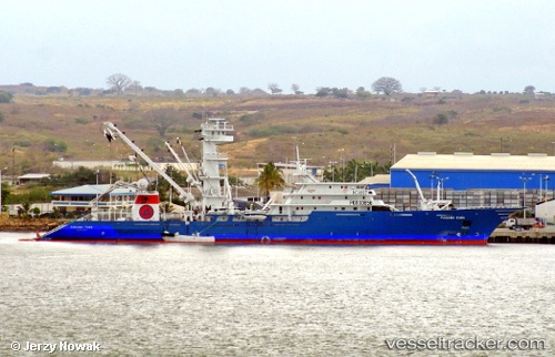
Panama Tuna
Current StatusWhere is the vessel?
Panama Tuna is currently in 222 nm SW of Caleta Tagus, based on AIS data received less than 1h ago.
Latest AIS update:
Current position: 1.73606° S, 94.75258° W (222 nm SW of Caleta Tagus)
Average speed (last 7 days): Loading…
Average speed (last 30 days): Loading…
Vessel profile: Panama Tuna is a Fishing Vessel with dimensions 16m x 115m.
This page combines live AIS, route history, probable destination signals, nearby traffic, and port activity for practical vessel monitoring.
The current position of vessel Panama Tuna is -1.73606 lat / -94.75258 lng. Updated: 2026-04-05 21:33:21 UTCNearest reference points:
- Open sea, approx. 419 nm off the nearest listed port
Details:
Live Vessel Panama Tuna Analytics (details, animations, etc.)
Recent AIS points (UTC):
2026-04-05 13:03:57 UTC · -1.15320, -96.66818 · SOG 14.2 kn · COG 104°2026-04-05 16:28:29 UTC · -1.38038, -95.89234 · SOG 13.8 kn · COG 107°
2026-04-05 21:33:21 UTC · -1.73606, -94.75258 · SOG 14 kn · COG 106°