 vesseltracker.com
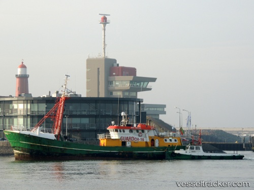
 LINDA C
Current Status
Where is the vessel?
LINDA C is currently in 13 nm N of Craven Arms, based on AIS data received about 1h ago.
Latest AIS update:
Current position: 52.63167° N, 2.95500° E (13 nm N of Craven Arms)
Average speed (last 7 days): Loading…
Average speed (last 30 days): Loading…
Vessel profile: LINDA C is a Utility Vessel with dimensions m x m.
This page combines live AIS, route history, probable destination signals, nearby traffic, and port activity for practical vessel monitoring.
The current position of vessel LINDA C is 52.63167 lat / 2.95500 lng. Updated: 2026-04-18 07:55:08 UTCNearest reference points:
- Near Craven Arms
- 21 nm S of Craven Arms
- 24 nm NE of Caister on Sea
Currently sailing under the flag of San Marino ![]()
Details:
Live Vessel LINDA C Analytics (details, animations, etc.)
Recent AIS points (UTC):
2026-04-18 02:26:33 UTC · 52.64005, 2.96949 · SOG 2.2 kn · COG -1°2026-04-18 04:11:32 UTC · 52.64651, 2.97160 · SOG 1.6 kn · COG -1°
2026-04-18 06:17:03 UTC · 52.63943, 2.96605 · SOG 0.9 kn · COG -1°
2026-04-18 07:55:08 UTC · 52.63167, 2.95500 · SOG 1 kn · COG -1°