 vesseltracker.com
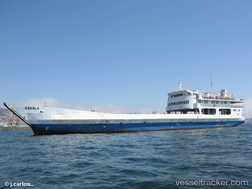
Kavala
Current StatusWhere is the vessel?
Kavala is currently in Near Puerto Montt, based on AIS data received about 1h ago.
Latest AIS update:
Current position: 41.51891° S, 73.03804° W (Near Puerto Montt)
Average speed (last 7 days): Loading…
Average speed (last 30 days): Loading…
Vessel profile: Kavala is a Passenger Landing Craft with dimensions 16m x 73m.
This page combines live AIS, route history, probable destination signals, nearby traffic, and port activity for practical vessel monitoring.
The current position of vessel Kavala is -41.51891 lat / -73.03804 lng. Updated: 2026-04-18 06:22:09 UTCNearest reference points:
- Near Puerto Montt
- Near Chonchi
- Near Quellón (Puerto Quellón)
Details:
Live Vessel Kavala Analytics (details, animations, etc.)
Recent AIS points (UTC):
2026-04-18 00:03:49 UTC · -41.81947, -72.97934 · SOG 8.3 kn · COG 349°2026-04-18 02:27:10 UTC · -41.52374, -73.03350 · SOG 2.6 kn · COG 338°
2026-04-18 03:55:59 UTC · -41.51894, -73.03804 · SOG 0 kn · COG 323°
2026-04-18 06:22:09 UTC · -41.51891, -73.03804 · SOG 0 kn · COG 323°