 vesseltracker.com
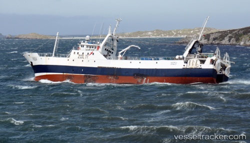
Castelo
Current StatusWhere is the vessel?
Castelo is currently in 79 nm N of Port San Carlos, based on AIS data received about 1h ago.
Latest AIS update:
Current position: 50.18650° S, 59.04210° W (79 nm N of Port San Carlos)
Average speed (last 7 days): Loading…
Average speed (last 30 days): Loading…
Vessel profile: Castelo is a Fishing Vessel with dimensions 11m x 70m.
This page combines live AIS, route history, probable destination signals, nearby traffic, and port activity for practical vessel monitoring.
The current position of vessel Castelo is -50.18650 lat / -59.04210 lng. Updated: 2026-04-19 01:36:23 UTCDetails:
Live Vessel Castelo Analytics (details, animations, etc.)
Recent AIS points (UTC):
2026-04-18 19:48:42 UTC · -49.79889, -59.27885 · SOG 4.1 kn · COG 123°2026-04-18 21:36:42 UTC · -49.85140, -59.11001 · SOG 3.9 kn · COG 114°
2026-04-19 00:18:32 UTC · -49.98791, -59.00443 · SOG 9.2 kn · COG 186°
2026-04-19 01:36:23 UTC · -50.18650, -59.04210 · SOG 9.2 kn · COG 185°