 vesseltracker.com
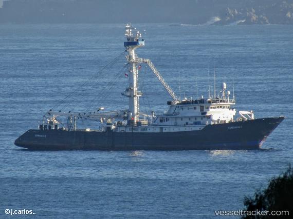
Almirante 1
Current StatusWhere is the vessel?
Almirante 1 is currently in 235 nm SE of Espanola Island, based on AIS data received about 36d ago.
Latest AIS update:
Current position: 4.27998° S, 87.03834° W (235 nm SE of Espanola Island)
Average speed (last 7 days): Loading…
Average speed (last 30 days): Loading…
Vessel profile: Almirante 1 is a Fishing Vessel with dimensions 13m x 78m.
This page combines live AIS, route history, probable destination signals, nearby traffic, and port activity for practical vessel monitoring.
The current position of vessel Almirante 1 is -4.27998 lat / -87.03834 lng. Updated: 2026-03-14 20:47:44 UTCDetails:
Live Vessel Almirante 1 Analytics (details, animations, etc.)
Recent AIS points (UTC):
2026-03-14 20:47:44 UTC · -4.27998, -87.03834 · SOG 10.5 kn · COG 253°