 vesseltracker.com
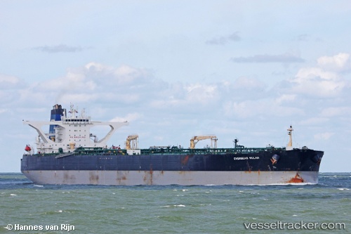
 MARINERA
Current Status
Where is the vessel?
MARINERA is currently in 134 nm NW of Billingborough, based on AIS data received about 105d ago.
Latest AIS update:
Current position: 54.65083° N, 22.29766° W (134 nm NW of Billingborough)
Average speed (last 7 days): Loading…
Average speed (last 30 days): Loading…
Vessel profile: MARINERA is a Crude Oil Tanker with dimensions 333m x 60m.
This page combines live AIS, route history, probable destination signals, nearby traffic, and port activity for practical vessel monitoring.
The current position of vessel MARINERA is 54.65083 lat / -22.29766 lng. Updated: 2026-01-05 07:35:34 UTCNearest reference points:
- 162 nm NW of Billingborough
Currently sailing under the flag of Russia ![]()
MARINERA built in 2002 year
Deadweight:
318518 tDetails:
Live Vessel MARINERA Analytics (details, animations, etc.)
Recent AIS points (UTC):
2026-01-05 07:35:34 UTC · 54.65083, -22.29766 · SOG 9.5 kn · COG 357°