 vesseltracker.com
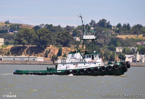
 Point Fermin
Current Status
Where is the vessel?
Point Fermin is currently in Near Interbay, based on AIS data received about 582d ago.
Latest AIS update:
Current position: 47.57397° N, 122.36066° W (Near Interbay)
Average speed (last 7 days): Loading…
Average speed (last 30 days): Loading…
Vessel profile: Point Fermin is a [tug.offshore_tug_supply] with dimensions 32m x 32m.
This page combines live AIS, route history, probable destination signals, nearby traffic, and port activity for practical vessel monitoring.
The current position of vessel Point Fermin is 47.57397 lat / -122.36066 lng. Updated: 2024-08-26 17:19:16 UTCNearest reference points:
- Near Interbay
- Near Madison Park
- Near Ballard/Seattle
Currently sailing under the flag of USA ![]()
Point Fermin built in 1976 year
Deadweight:
200 tDetails:
Live Vessel Point Fermin Analytics (details, animations, etc.)
Recent AIS points (UTC):
2024-08-26 17:19:16 UTC · 47.57397, -122.36066 · SOG 0 kn · COG 85°