 vesseltracker.com
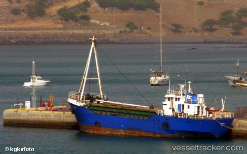
 DARLA
DARLA
Current Status
Where is the vessel?
DARLA is currently in Near Koper, based on AIS data received less than 1h ago.
Latest AIS update:
Current position: 45.56889° N, 13.71570° E (Near Koper)
Average speed (last 7 days): Loading…
Average speed (last 30 days): Loading…
Vessel profile: DARLA is a Livestock Carrier with dimensions m x m.
This page combines live AIS, route history, probable destination signals, nearby traffic, and port activity for practical vessel monitoring.
The current position of vessel DARLA is 45.56889 lat / 13.71570 lng. Updated: 2026-04-01 19:40:08 UTCNearest reference points:
- Near Ankaran
- Near Trieste
- Near IZOLA
Currently sailing under the flag of Comoros ![]()
DARLA built in 1977 year
Deadweight:
2456 tDetails:
Live Vessel DARLA Analytics (details, animations, etc.)
Recent AIS points (UTC):
2026-04-01 13:52:10 UTC · 45.56882, 13.71556 · SOG 0.6 kn · COG 25°2026-04-01 15:25:11 UTC · 45.56960, 13.71497 · SOG 1 kn · COG 105°
2026-04-01 17:31:08 UTC · 45.56907, 13.71535 · SOG 0.8 kn · COG 32°
2026-04-01 19:40:08 UTC · 45.56889, 13.71570 · SOG 0.3 kn · COG 22°